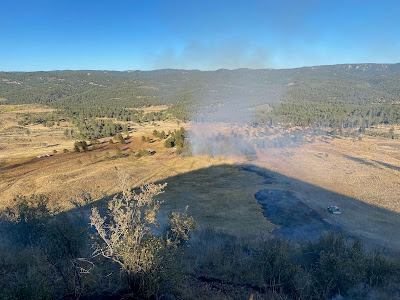
Turkey Tracks 5 Fire
Time Reported: 09/24/2024 1:41 pm
- Size: 37 acres
- Location: Teller County, 6.92 miles NW of Woodland Park, Colorado. Pikes Peak Ranger District
- Jurisdiction: US Forest Service
- Resources: Multiple engines and resources from USFS, Northeast Teller County, Douglas County and Mountain Communities Volunteer Fire Department
- Containment: 100% 9/25/24 @7:00pm for 37 acres
- Controlled: 9/30/24 12:37pm for 37 acres
- Structures Threatened: None
- Evacuation: None
- Closures: None
- Cause: unknown
- Fuels: grass and hazardous target shooting debris
- #TurkeyTracks5Fire_CO
Update 9/25/24 11:30am: Crews continue to clean up unburned pockets of fuel in the interior of the fire area. The public can expect to see smoke in the area as firefighters continue to do work this fire. The fire remains in its same footprint at the time of the last report last evening. Firefighters have accurately mapped the footprint of the fire and the updated acreage is 30 acres. The 100 acres was a visual estimate from firefighters as they were working the fire last night. The Turkey Tracks area remains closed due to the fire activity and it is expected to remain closed until firefighters have contained the fire.
Update 9/24/24, 6:00pm: The Turkey Tracks 5 Fire is approximately 100 acres after the firing operation that firefighters completed. The Turkey Track fire is in an area heavily used for target shooting and there are large amounts of trash and unspent ammunition of all kinds in the area which presents multiple hazards to firefighters. This area historically has anywhere from 5-10 fires annually due to target shooting and fire managers have built fire breaks to help protect the surrounding communities from fire. Today, firefighters took an opportunity to utilize these existing fire breaks in the area to burn off the grass, and various types of trash in the area. This not only helps keep firefighters from having to make a direct attack on the fire amongst the hazardous debris, but it also clears the area of available vegetation/grass to prevent fires in the future further protecting the nearby communities. The weather conditions along with the correct resource support from Northeast Teller County Fire, Douglas County and Mountain Communities Volunteer Fire Department made the operation possible and successful. The public and residents nearby can expect to see smoke over the next couple days as the interior fuels continue to consume. Firefighters will remain on scene this evening and the next few days. Target shooters can expect the area to be closed to access for the next several days as firefighters continue to mop up the fire.


